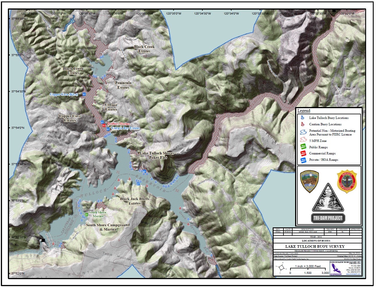
Tulloch Reservoir Buoy Location Map
Welcome to Tulloch Reservoir
Licensed by the Federal Energy Regulatory Commission and operated by the Tri-Dam Project, a partnership of the Oakdale Irrigation District and South San Joaquin Irrigation District.
Tulloch Reservoir offers many enjoyable recreational activities. For the safety and enjoyment of all users, law enforcement services are provided by the Calaveras County and Tuolumne County Marine Safety Units. Please observe the following safety rules:
- All boat travel must be in a counterclockwise direction.
- The number of passengers or cargo aboard a boat must not exceed the listed capacity.
- The maximum speed is 45 mph at any time on any portion of the lake, except in restricted speed zones, where the maximum speed is 5 mph.
- The maximum speed is 5 mph between sunset and sunrise.
- The maximum speed is 5 mph within 100 feet of a swimmer.
- The maximum speed is 5 mph within 200 feet of the following:
- A beach frequented by swimmers
- A swimming float, diving platform, or lifeline
- A way or landing float used for embarking or disembarking passengers
Additional Safety Information
- California Boater Card Requirement: All operators of motorized vessels must possess a valid California Boater Card.
-
Common Sense Safety Rules:
- Always wear a life jacket while boating.
- Stay alert and avoid distractions.
- Keep a safe distance from other boats and swimmers.
- Ensure your vessel is in good working order before heading out.
Thank you for helping us keep Tulloch Reservoir a safe and enjoyable place for everyone!
Here you will find the Tulloch Reserviors Buoy Placement Map.